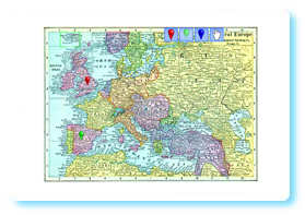
 This group of interactive whiteboard resources utilises a number of maps that have passed into the public domain due to their age.
When the map appears there is a green box in the top left. Drag this to the point on the map that you wish to zoom into. Once zoomed in you can drag the map around. You can place map pins by selecting the appropriate colour and then clicking where you would like to position it. Clicking on a placed map pin removes it. Clicking the hand icon lets you go back to scrolling the map. Clicking unzoom does what you would expect.
Some of the maps are more useful for a historic perspective than a geographic one. The European one, for example, shows the political boundaries of just before World War One. The Africa map shows the dominance of the colonial powers at the time. The USA map was historical at the time of its creation so should still be useful for explaining the development of the USA’s boundaries. Canada and Australia are also shown as they were in 1910.
Go to Europe interactive whiteboard resource.
Go to USA interactive whiteboard resource.
Go to Africa interactive whiteboard resource.
has any one got any map resources to use for functional/key skills L2 that will use scales/ratios?